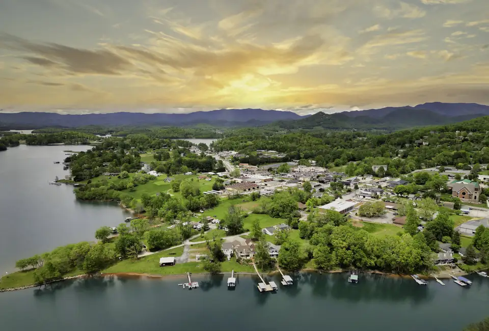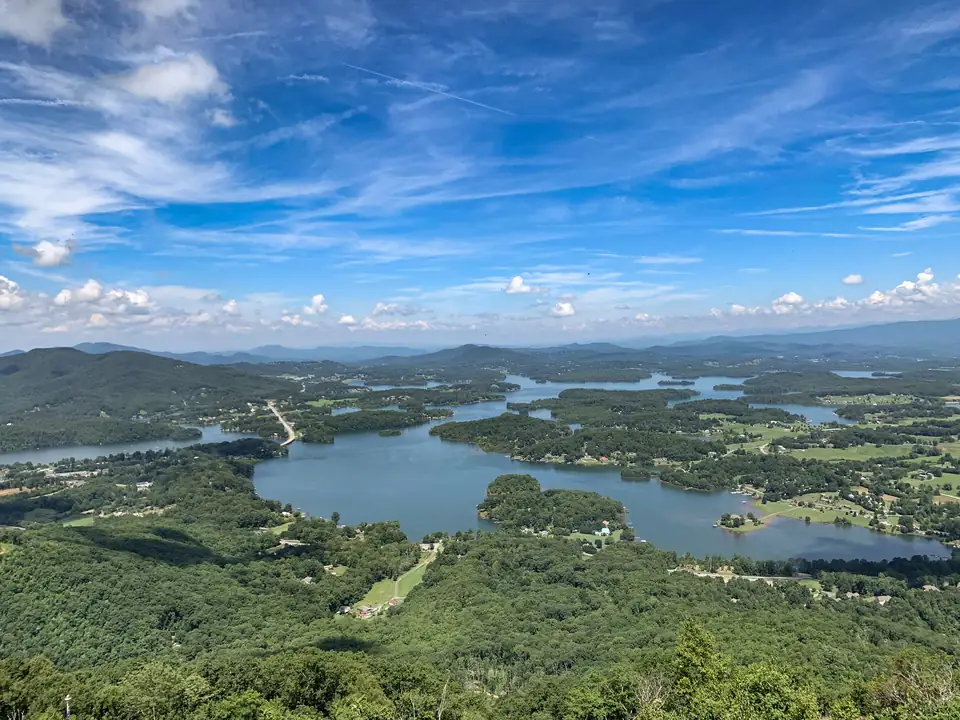
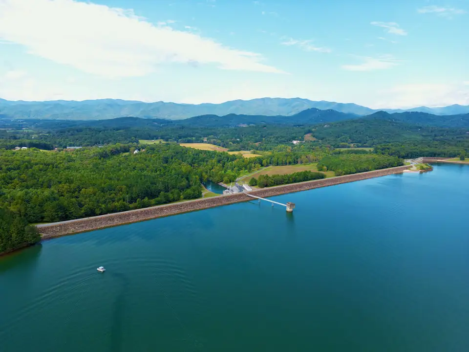
Lake Chatuge is in both states. The Federal Register notice for TVA’s dam project describes a reservoir about 13 miles long that runs southeast from Chatuge Dam, in Clay County, North Carolina, into Towns County, Georgia. The Georgia shore has Hiawassee and Young Harris. The North Carolina shore has Hayesville and the Shooting Creek arm.
TVA’s official name for the lake is Chatuge Reservoir. Most people call it Lake Chatuge, and the dam’s National Register nomination uses both names. It is one lake with one water level, but the state line across it changes a few practical things: which fishing license works where, which boating rules you can count on, and which county office you call. Here is how it breaks down.
Decision tool
Georgia shore or North Carolina shore?
Pick what you have in mind. We'll point you to the side of the lake and the place that fits, with the season, the fee and the source.
I want to…
If you want to swim from a beach
Georgia side: Towns County Beach in Hiawassee is free for swimming and picnics. North Carolina side: Jackrabbit Mountain's sandy beach (May 1 to September 30, $5 per vehicle) and the beach at Clay County's Recreation Park near the dam.
Towns County Beach (Towns County Recreation Area), Georgia
County beach open to the public free of charge for swimming and picnics, with a full playground and reservable picnic shelters. Georgia DNR lists the Towns County Recreation Area as Lake Chatuge's designated swimming area.
Source: Towns County, GA, checked Oct 17, 2026
Jackrabbit Beach (swim area), North Carolina
Designated swimming area and sandy beach with picnic tables on a grassy lawn, plus an accessible fishing pier nearby.
Source: US Forest Service, checked Nov 4, 2026
Clay County Recreation Park (campground, beach, boat ramp), North Carolina
County-run lakeside campgrounds (Recreation Park and Gibson Cove) with a beach swimming area, pavilions, a public boat ramp between the two campgrounds, and a paved path that continues across Chatuge Dam. The county site is taking 2027 campsite lottery applications.
Source: Clay County, NC, checked Nov 4, 2026
- Georgia DNR lists the Towns County Recreation Area as the lake's designated swimming area under the Georgia Boat Safety Act.
If you want to launch my own boat
Georgia side: the Forest Service's Lake Chatuge Recreation Area is free and has motorized boat access, and Mayor's Park Boat Landing has a 26-foot concrete ramp. North Carolina side: Clay County's ramp sits between its Gibson Cove and Recreation Park campgrounds near the dam.
Lake Chatuge Recreation Area (Chattahoochee-Oconee NF), Georgia
Forest Service day-use site in Georgia with motorized boat access and day hikes. There is no potable water, so bring your own.
Source: US Forest Service, checked Nov 4, 2026
Mayor's Park Boat Landing, Georgia
Georgia DNR-funded ramp dedicated in 2017: a 26-ft concrete ramp with 24 trailer spaces plus 10 car spaces.
Source: Georgia DNR, checked Nov 4, 2026
Clay County public boat ramp (between Gibson Cove and Recreation Park), North Carolina
One of Clay County's public boat ramps, between the Gibson Cove and Recreation Park campgrounds near Chatuge Dam.
Source: Clay County, NC, checked Nov 4, 2026
- In Georgia waters, anyone born on or after January 1, 1998 needs an approved boater education course to run a motorboat.
- We have not verified North Carolina's boating rules; check the NC Wildlife Resources Commission before you launch on that side.
If you want to rent a boat
Lake Chatuge Marine, family owned since 1972, lists boat rentals, service and on-dock fuel. The Ridges marina rents pontoons and jet skis. Both are on the Georgia side.
Lake Chatuge Marina / Lake Chatuge Marine, Georgia
Family-owned since 1972, offering boat rentals, sales, service, storage and on-dock fuel.
Source: Lake Chatuge Marine, checked Oct 17, 2026
The Ridges Marina (The Ridges Resort), Georgia
Resort-owned marina that rents jet skis and pontoons on Lake Chatuge.
Source: The Ridges Resort, checked Oct 17, 2026
- Georgia law bars renting a boat of 10 horsepower or more to anyone under 16.
- Call ahead: we could not find dated 2026 hours for either marina.
If you want to camp by the water
North Carolina side: Jackrabbit Mountain has 92 bookable sites on Recreation.gov (the Forest Service says 100) on a peninsula, open May 1 to October 31, reservations required. Georgia side: the Georgia Mountain Fairgrounds has 207 lakeside sites open year-round, and the county's Chatuge Woods runs April through October.
Jackrabbit Mountain Recreation Area campground (Nantahala NF), North Carolina
92 bookable sites on Recreation.gov (the Forest Service says 100) in three loops on a Lake Chatuge peninsula. No hook-ups. Reservations are required on Recreation.gov. Also has a 15-mile mountain bike trail system, the 2.4-mile Jackrabbit Mountain Trail and motorized boat access.
Source: US Forest Service, checked Nov 4, 2026
Georgia Mountain Fairgrounds Campground, Georgia
207 campsites on the shores of Lake Chatuge, open year-round.
Source: Georgia Mountain Fairgrounds, checked Oct 17, 2026
Chatuge Woods Campground (Towns County), Georgia
30-acre county campground directly on Lake Chatuge with water and electric at each site, two bath houses and an adjacent public boat ramp.
Source: Towns County, GA, checked Nov 4, 2026
- The Forest Service's Lake Chatuge Recreation Area in Georgia is day use only.
- Jackrabbit sites have no hook-ups.
If you want to fish from the bank or a dock
Buy the license of the state you are standing in. The Georgia and North Carolina reciprocal agreement only covers fishing across the line from a boat that is not anchored to shore or tied to a dock.
Jackrabbit Beach (swim area), North Carolina
Designated swimming area and sandy beach with picnic tables on a grassy lawn, plus an accessible fishing pier nearby.
Source: US Forest Service, checked Nov 4, 2026
Lake Chatuge Recreation Area (Chattahoochee-Oconee NF), Georgia
Forest Service day-use site in Georgia with motorized boat access and day hikes. There is no potable water, so bring your own.
Source: US Forest Service, checked Nov 4, 2026
- Jackrabbit has an accessible fishing pier near the swim beach (North Carolina).
- Below the dam, trout gather at TVA's weir and wade fishing is popular.
If you want to fish from a boat
A valid Georgia or North Carolina license covers hook-and-line fishing on all of Chatuge Reservoir from a boat, including boat-reachable tributaries. Each state's other rules, like limits, still apply in its own waters.
Lake Chatuge Recreation Area (Chattahoochee-Oconee NF), Georgia
Forest Service day-use site in Georgia with motorized boat access and day hikes. There is no potable water, so bring your own.
Source: US Forest Service, checked Nov 4, 2026
Clay County public boat ramp (between Gibson Cove and Recreation Park), North Carolina
One of Clay County's public boat ramps, between the Gibson Cove and Recreation Park campgrounds near Chatuge Dam.
Source: Clay County, NC, checked Nov 4, 2026
- The Forest Service lists spotted, white and striped bass, catfish, crappie and sunfish in the lake.
If you want to walk or hike
Walk across Chatuge Dam on the path from Clay County's campgrounds (North Carolina), loop the 2.4-mile Jackrabbit Mountain Trail, or climb the steep 0.6-mile paved trail to Georgia's highest point at Brasstown Bald.
Chatuge Dam (TVA) and dam-crest walk, North Carolina
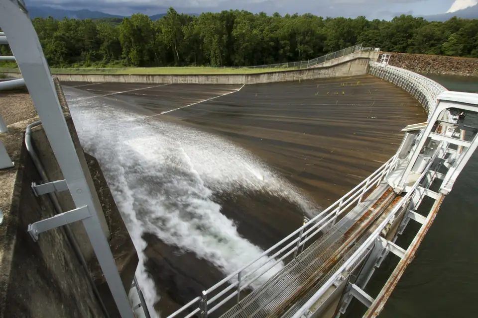
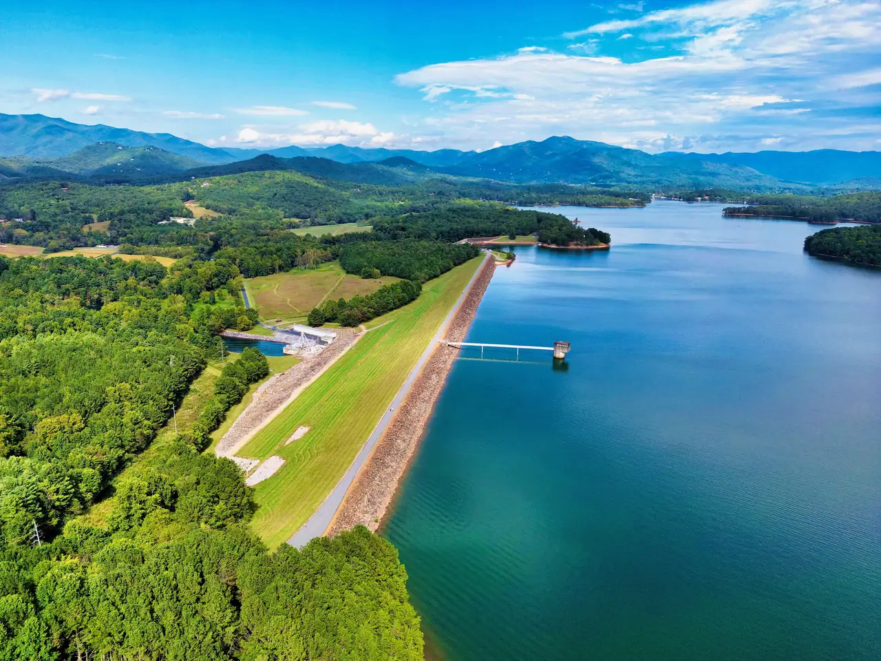
TVA's 1942 earth-fill dam, 150 ft high and 3,336 ft long, in Clay County, NC, about two miles north of the Georgia line. A road on the crest is used as a public walking trail, and Clay County's paved path from its Recreation Park continues across the dam. Listed on the NRHP in 2017.
Source: NC State Historic Preservation Office (NRHP), checked Oct 17, 2026
Jackrabbit Mountain Recreation Area campground (Nantahala NF), North Carolina
92 bookable sites on Recreation.gov (the Forest Service says 100) in three loops on a Lake Chatuge peninsula. No hook-ups. Reservations are required on Recreation.gov. Also has a 15-mile mountain bike trail system, the 2.4-mile Jackrabbit Mountain Trail and motorized boat access.
Source: US Forest Service, checked Nov 4, 2026
Brasstown Bald Visitor Information Center (Chattahoochee-Oconee NF), Georgia
Georgia's highest point (4,784 ft), with a 360-degree observation deck over four states, a museum and three trailheads. The paved summit trail is 0.6 miles and very steep.
Source: US Forest Service, checked Oct 17, 2026
- Brasstown Bald costs $10 per person 16 and older, shuttle included.
If you want to catch a concert or the fair
The Georgia Mountain Fairgrounds in Hiawassee holds big-name concerts at Anderson Music Hall and posts the 2027 Georgia Mountain Fair for August 13 to 21.
Georgia Mountain Fairgrounds and Anderson Music Hall, Georgia
Lakeside fairgrounds in Hiawassee that calls itself the Country Music Capital of Georgia. It hosts the Georgia Mountain Fair and Fall Festival, concerts at Anderson Music Hall and holiday light shows. The 2026 and 2027 calendar is posted.
Source: Georgia Mountain Fairgrounds, checked Oct 17, 2026
- Hamilton Rhododendron Gardens, at the top of the fair parking lot, blooms from early April into May.
Seasons and fees as each operator publishes them, checked October 17, 2026. Confirm before you go.
Which towns and counties are on each side
The dam’s National Register nomination describes a reservoir of about 7,000 acres with 132 miles of shoreline in Towns County, Georgia, and Clay County, North Carolina. From the dam, the lake reaches thirteen miles south along the Hiwassee River and six miles east along Shooting Creek. Parts of it lie in two national forests, one in each state.
| Question | Georgia shore | North Carolina shore |
|---|---|---|
| County | Towns County | Clay County |
| County seat | Hiawassee, on the lake, incorporated May 17, 1956 (City of Hiawassee) | Hayesville, incorporated March 12, 1913 (Town of Hayesville) |
| Other places | Young Harris, home of Young Harris College | The Shooting Creek arm of the lake |
| National forest | Chattahoochee National Forest | Nantahala National Forest |
| Chatuge Dam | Not on this side | Yes, in Clay County |
Our town guides cover each shore in more depth: Hiawassee, Georgia and Hayesville, North Carolina.
Where the dam is
Chatuge Dam is in North Carolina. The National Register nomination places it at mile 121 on the Hiwassee River, three miles southeast of Hayesville and two miles north of the Georgia state line. TVA says construction began in 1941 and was completed in 1942, and that the dam is 150 feet high and stretches 3,336 feet across the river.
So the water you see from Hiawassee is held back by a dam in another state. Below the dam, the Hiwassee River keeps flowing north and west through North Carolina until it joins the Tennessee River in Meigs County, Tennessee. The crest road on the dam is a public walking trail, and our Chatuge Dam walk guide explains how to see it on foot.
Fishing licenses: one lake, two states, one catch
Georgia and North Carolina have a reciprocal agreement for Chatuge. Under North Carolina’s rule, 15A NCAC 10C .0203, valid Georgia and North Carolina fishing licenses are honored for hook-and-line fishing in all of Chatuge Reservoir, including tributary water you can reach by boat.
The catch is where you are standing. The same rule lets you fish across the line on your home-state license only from a boat that is not anchored to the shore or tied to a pier or dock connected to the shore. If you fish from the bank or from a dock, you need a license from the state you are standing in.
Fishing on the other state's side of the line under the reciprocal agreement is allowed only from a boat that is not anchored to the shore or tied to a pier or dock connected to the shore. Bank and dock anglers need a license from the state they are standing in. (NC Admin. Code (NCWRC rule), checked Oct 17, 2026)
A few more points from the two states’ rules:
- Each state honors the other’s senior and youth license exemptions on Chatuge.
- All of Georgia’s other fishing rules apply in the Georgia part of the lake, and North Carolina’s apply in the North Carolina part, per Georgia’s fishing regulations. Creel and size limits can differ, so check the rules for the water you are on.
- Shore fishing at Jackrabbit Mountain, the Forest Service site on the North Carolina side, puts you on North Carolina ground, so a North Carolina license applies there.
Our Lake Chatuge fishing guide covers species and places to fish on both shores.
Boating rules: Georgia’s are clear, so check North Carolina’s
We verified Georgia’s rules with the Georgia DNR. In Georgia waters, anyone born on or after January 1, 1998 must complete an approved boater education course before operating any motorized vessel, a requirement in effect since July 1, 2014. Georgia also bars renting any vessel of ten horsepower or more to anyone under 16, per the DNR’s rental boat rules.
North Carolina sets its own boating rules for its part of the lake. We have not verified them, so we do not repeat them here. Before you run a boat on the North Carolina side, check with the North Carolina Wildlife Resources Commission, including whether your registration and any boater education card are recognized there. Our boating guide lists ramps on both shores.
Swimming on each shore
Georgia DNR’s boating rules list the Towns County Recreation Area as Lake Chatuge’s designated swimming area. Towns County says its beach is open to the public free of charge for swimming and picnics, with a full playground. On the North Carolina side, the Forest Service’s Jackrabbit Mountain Recreation Area has a designated swimming area and sandy beach, and Clay County’s Recreation Park has a beach swimming area next to its playground and picnic area.
Hiawassee or Hiwassee?
Both spellings are right, for different things. The town in Georgia is Hiawassee, with an “a” after the “Hi”. The river that feeds and drains the lake is the Hiwassee, which is how TVA, the National Register and the Federal Register all spell it. Giving the river the town’s spelling is the most common mistake people make about the lake.
The City of Hiawassee says its name comes from the Cherokee word Ayuhwasi, which means “meadow”. That is the city’s own account. For the lake’s name, TVA says only that the reservoir is named after a nearby Cherokee settlement, and the National Register nomination calls it an eighteenth-century Cherokee village that once stood near the dam site.
What does not change at the state line
The lake has one water level, set by TVA at the dam. In a year with normal rainfall, TVA says the level varies about 10 feet between summer and winter. Its guide curve, described in the Federal Register notice, bottoms out at 1,915 feet in mid-February and peaks at 1,926 feet around Memorial Day. For today’s reading, use TVA’s Chatuge lake-level page.
Docks are the other constant. A TVA Section 26a permit is required before any shoreline construction, on either shore, and our guide to 26a dock permits explains how that works when a lake home changes hands.
Questions about Lake Chatuge and the state line
Is Lake Chatuge in Georgia or North Carolina?
Both. The reservoir is about 13 miles long and runs southeast from Chatuge Dam in Clay County, North Carolina, into Towns County, Georgia. Hiawassee and Young Harris are on the Georgia side, and Hayesville is on the North Carolina side.
Source: Federal Register, checked Oct 17, 2026
Which state is Chatuge Dam in?
North Carolina. The dam's National Register nomination places it in Clay County, three miles southeast of Hayesville and two miles north of the Georgia state line.
Source: National Register nomination, checked Oct 17, 2026
Can I fish all of Lake Chatuge with a Georgia or North Carolina license?
Only from a boat. Under the Georgia and North Carolina reciprocal agreement, either state's license is honored across the line only from a boat that is not anchored to shore or tied to a dock or pier connected to shore. Bank and dock anglers need a license from the state they are standing in.
Source: 15A NCAC 10C .0203, checked Oct 17, 2026
Is it spelled Hiawassee or Hiwassee?
Both are correct for different things. The town in Towns County, Georgia is Hiawassee. The river the lake sits on is the Hiwassee, which is how TVA spells it.
Source: TVA, checked Oct 17, 2026
Written by the Visit Lake Chatuge Editorial Team. AI tools help us draft; people check every fact before it publishes.